
Wetherlam by the Edge
Fed up of waiting for the ‘hottest day of the year’ to materialise, we left home in drizzle with hope! By the time we had parked at Tilberthwaite, NY305 011 the rain had stopped though it was hardly scorching.
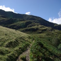
Our route map is here. The path up to the East of Blake Rigg, is a steep, not so used alternative to the route up Tilberthwaite Gill. Once it flattens out cut east and North of Hawk Rigg to join the main trial up to Wetherlam. If you decided to take this path the point to turn left up the hill is just by a gate on the right, marked no entry.
Following the horrendous rain of the past few days the levels were pretty wet and squishy and water was pouring out of two old mine entrances on the way up. One shaft had become home to this spider.

Anyone any idea what he is? Whatever the name he had two juice moths in his web so his squatters rights had been successful.
Joining the main track the cloud was still sat laconically over the top of Wetherlam and the Edge and the wind was picking up. There seemed little hope of any wonderful Lake views, and the prospect of walking along an ‘Edge’ was a little daunting. But there were others heading in the same direction, and for once, it was quite comforting to ‘join a crowd’.

Wetherlam Edge is quite a scramble. The recent rain had loosened the scree even more and I was glad of the company of Chris and Janet, along with their two Labradors, whom had been up the route before and did the navigating for us. Going up this was was a bit tricky and I certainly would not have enjoyed trying to go down it.
And the top! That joyous feeling of achievement and the reward of the most wonderful vistas in the world!

Hum, it was not a place to stop for lunch. Every mindful of the drop in body temperature as the climb stops, we donned coats etc. and set off across the top, meandering between the tarns and puddles when suddenly there was a tantalising glimpse of blue above and then Coniston Lake below.

Then the clouds began to produce an ‘awesome’ aerial display. We found a sheltered spot to sit and watch the performance while eating a rather late lunch. The cloud dropped first down in to valley, parting to blue appeared above, then drifted away to nothingness. Revealing rolling green, as far as Morecambe Bay, beyond Windermere and the ever present Langdales. The Old Man was a little more reluctant to let go of his cover but we could see Levers Water and the route we had walked a couple of months before. Low Water Beck a white, shimmering torrent cascading down, so full it could be seen for miles.

There are some dramatic rocks on the way down, The Lad Stones I think, which proved a dramatic foreground to the increasingly clarity of Coniston. Once passed the rocks into the beautiful glacial valley and bowl of Cook Beck, which we crossed and walked to the east, where the path is more clear. The rest of the walk was a stroll in delightful warm, summer shine, with stops along the way to shed the fleeces and windproofs necessary on the top. Wetherlam was, by now, totally clear!

More pictures here
Check out my site for Wainwright and other books, can buy your map too!
Like my facebook page and follow me on twitter
No Comments
Trackbacks/Pingbacks