
Off the Beaten Track
The long evenings are here with us again and so even when walking can only commence after lunch there is still time for a walk.
The lower fells to the west of Coniston with scudding clouds and dappled light may not be so dramatic as the central fells but the open moorland bowls of Torver Fell have their own beauty and present their own challenges.
We did follow a route described in a cicerone book starting from a layby on the Greenodd to Coniston Road A5084. This mini horseshoe skirts around the sides of Torver common with the highest point being Beacon Fell 254 and about 5.5miles, so not long compared to recent conquests of Fairfield and Kentmere.
But you would be ill advised to set off without a compass in low cloud. The common is open access land and only part of the route follows public footpaths, so it is not all marked on the OS map. Nor are the paths all visible on the ground. There is a large are of peat bog, Rosie dog resembled a pig at one stage and did not approved of being unceremoniously dumped in a tarn for an impromptu bath. There is a definite technique to finding tufts which do not sink to above boot height and our progress resembled an odd game of hopscotch. When not in bog, areas of heather impeded our progress up the hills and inclines. A time when being terrier height was an advantage. Going under the heather was a good technique. It is not a walk you would want to do in shorts.
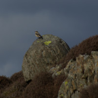
So, have I succeeded in putting you off? Don’t be. If you don’t like walking on the necessary stone walkways of the more popular peaks, and do like a touch of solitude then it will ‘suit you just grand’. Aside from a couple of other walkers returning to their car as we set off we didn’t meet anyone else all afternoon. Dow Crag and The Old Man of Coniston escorted us throughout. Tarns of various sizes dotted the route with sky larks and wheatears in romantic mood singing and sparing for territory. Once at the top of the shoe on Fisher High the Duddon Estuary stretches out to the south and remains in view until Beacon Fell when the full length of Coniston Lake unfolds. The back drop of hills included Wetherall, Fairfield and Kentmere’s Ill Bell.
From the final small ascent of Tottle bank the marsh area of Mere Moss, the pivotal point of the walk, resembles a shallow bowl, inhospitable, yet beautiful, left to the preserve of nature.
The walk was around 5.75 miles, highest peak. Park at a small car park on the edge of Torver fell at SD288928. If you don’t have the book, then a circle of paths can be navigated from OL6 Rememeber you will find a like to the OS map site here, Cicerone books here, and any other books, CD’s DVDs etc here!
For those of you reading this direct from email, you may not be able to see the slide show – (I’m still learning some new widgets I have installed) – so please click here to see the page on online. Enjoy.
[scrollGallery id=2]
No Comments
Trackbacks/Pingbacks