Needle in a Haystack
In my rather slow trek towards Mountain Leader status I’ve to make sure I can navigate myself without the aid of all the great technology and GPS. So it’s out with the map and compass.
A battle with a meter square of robust paper marked with all the squiggles and dots unique to Ordnance Survey, or you can simply cut up the map into smaller squares? Now OS is online the relevant bit can be printed out, or just download the bit of map to iPhone. Surely not cheating as the download, unlike the app, won’t tell me where actually am, yet saves the fight with the elements, and zooms in!
But paper is still needed to stick a compass on, drill down to the tiniest of squiggles and get over to the next one.

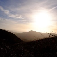
Lose Hill
Hence a trip out Kinder Scout to find my way around a flat, feature less bog. Or at least that is how it was described to me.

Druid Stone
So featureless what could be there to find?
Crashed aircraft! Kinder Scout has been rather an unlucky place over the years and there are several remains of planes. Not much is left now but they are there to find.

Colourful peat bog
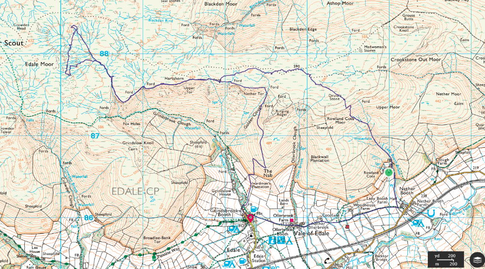
With them plotted on a section of OS map, printed out by my much more organised partner in ML skills, we headed up Lady Booth Brook from Edale YHA. My first task to find the Druid’s stone. Hardly an auspicious task. With far too mild winter sunshine and so far cloudless skies, this weathered monolith sits on the edge of the moor. Standing out like the proverbial sore thumb.

Crash site
More of a task was tracing some bits of plane wreck somewhere. Grid references are all well and good with a GPS but not in the peaty moor with ‘no distinguishing marks’. Particularly when they could be hidden in an eroded ‘clough’. A colloquialism which I was about to become very familiar over the next few hours.
As there is a trig point, which I knew would at least stick up from ground level, we headed off in that direction. May be more by luck than judgement I practically fell over some rather unimposing bits of wreckage.
Don’t get too excited. These are hardly recognisable bits of machinery but poignant non the less.

Shooting Butt
Next on the list was the remains of a grouse shooting hut. What kind of friends have I to think of these things, and then be mad enough to come with me? In this case on a thigh burning traipse across peat bog where it is practically impossible to walk in a straight line. Heading for a vast grey cliff face I thought would be easy. It became a slithering hike up and down mini peaty cliffs. Never underestimate 3m in height. Dark black peat, sodden with weeks of rain takes some negotiating. Going either up or down. Not that it bothered the Arctic Hare as it traversed the skyline, bouncing the cloughs with ease.

Upper Tor
Once down in the ‘clough’ whatever was visible on the skyline disappears and there’ll be a peaty brown soup to negotiate before you rise up, gopher like. Chances are you’ll come out facing a different direction.
You’ll see from the route the distinct wiggles in the ‘direct line’ from the trig to the ridge path which we used to complete the way Upper Tor.

Grindsbrook Clough
Bit of a rest for the legs as we followed the track for most of the way towards the grouse shooting hut. Nestled in the re-entrant close to the source of a stream, it wasn’t too difficult to find. Then it was time to launch back into the peat bog and attempt to find some more bits of plane. Which amazingly we did!
Ok, the last 10m or so needed a bit of direction from the GPS but they were hidden down between the cloughs.

Stream bed washed free of peat
And so it was time to get off the hill. The wind had picked up, cloud was dropping and I was beginning to have a distinct sense of humour failure as far as peat bog was concerned. On the basis that water flows downhill, we hit the bottom of a clough which had cleared itself of a millenniums worth of peat. With the help of ground tougher than pavement it was an easy walk back to the edge path and an easyish walk down, courtesy of whoever ‘fixes’ the moorland of Kinder.
More on the plane crashes here and here
Our route.