
Which Way to Walk up Helvellyn?
I was up Helvellyn last week. A glorious blue sky day in what I am sure is going to be remembered as the ‘summer of 2018’. So many continuous days of Cumbrian sunshine. Unusual and welcome.
A chance encounter with a friend, whom I also met on my last hike up this particular hill in the lovely February snow, made me start to wonder how many ways there are to walk up the hill, or go down, and how many I had set foot on since my fist walk up from Thirlmere aged about ten.
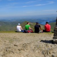
As always on a good weather day there was a larger congregation that seemed possible from the few I had encountered on my journey up Swirral. This phenomena happens a lot on the more well known Lake District summits. I’ve frequently got to the top of Scafell, Fairfield, Helvellyn and Coniston Old Man to wonder where all the people had come from? What is it with these hills?
The ancient volcanic geology of Cumbria has been sculpted by ice ages into a wheel like topography. Deep valleys ground spoke like from central hubs which have been populated over centuries by ancient rights of way.

Lanty’s Tarn
From the summit of Helvellyn four paths spread and divide as they move away. Starting points for the hike becoming far more than their point of convergence.
For the most challenging ways head slightly south, then east to the infamous Striding Edge. A ridge which has claimed the lives of the unlucky. Less vertigo inducing is the more Northerly edge of Swirral. Take those two out of the mix and the rest of the ‘legal rights of way’, footpaths and bridle ways, are just ‘walks’, all be it of different lengths and incline.

Route to Helvellyn by Grisedale beck
One of the prettiest and perhaps the least strenuous, is the route I took last, up the north side of Grisedale Beck.

Red Tarn
Trace the web away and you’ll drop east to Ullswater, Glenridding and Patterdale. The southerly routes will land you in Ambleside and Rydal. Along Thirlmere to the west there are the shortest, sharpest paths to the top from a string of small car parks along the edge of the reservoir. St Johns in the Vale, Walthwaite then round to Dockray are starting points if you’re arriving from the north.

Swirral Edge route to Helvellyn
Taking the core four down to the surrounding public roads I traced 29 starting, or ending points of which I have only done a fraction.
Mostly I’ve done them as elliptical or spherical days, though once I headed north from Threkeld and ended up in Rydal. A good day and a half with camp in the middle. One of the more unusual was from a camp at Hard Tarn, a bit of a scramble up to the ridge at Nethermost before the final hike up.

Helevllyn and theEdges from Red Tarn
I’ve been up in all sorts of weathers, some with wonderful snow, with all sorts of people, family, friends and more recently clients. I’ve even met a royal up there in 2009.

Yes, on Helvellyn
On a old tatty map I traced as many routes as I could find. I came to 29 points where either bridleways or footpaths reach a public road. Although I’ve started shorter walks from many of the points, I’ve started/finished from, I think, only 9 to or from the summit of Helvellyn. Grid references available on request.

How many have you started from?