
Technological Rescue
The mist sat on the hills, just for a change.
We went for a walk anyway. Sargent Man and High Raise, a couple of hills up behind Stickle Tarn in Langdale, were destinations of the day.
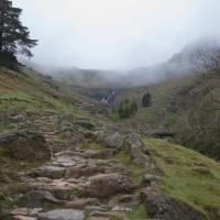
The scramble up Stickle Ghyll was clear, but an eerie silence and stillness spread over the tarn. Someone had removed Pavey Arc.
Our navigation skills were seriously challenged. Every thing changes place in the mist.

Stickle Tarn
I was almost convinced by Silva compass had stopped working at one stage. My friend did tell me I was being a bit ridiculous. Thankfully we followed its suggestion, not mine. Much to my amazement we found Sergeant Man, right where it should be. No one had moved it. Not that we would have known it was Sergeant Man without asking people already on it. There was no view and little to distinguish it from the other mounds around.

Sergeant Man
Feeling extremely pleased with ourselves, and somewhat over confident we stuck off in the direction of High Raise. Still in the mist. The difference being that there were no real features to check. On the way up the hill there were streams and crags to place ourselves, now there was nothing. Bar the odd old metal fence post, and a few Herdy sheep.

Confidence gone, we were just about to give up when another mad person, with dog, came yomping up behind us. He was, horror of horrors, using a GPS system. Oh joy, we were about to be rescued by someone using technology. How happy can you be. Even better, he told us we were only 200 m from High Raise. Fantastic.

Ridge towards Harrison Stickle
We almost lassoed him, for that last 200m. Then, better still, he was going back the way we had planned, towards Harrison Stickle. So we stuck like glue to the hand with the GPS. Let me be clear though, he didn’t quite trust the technology, we did have to make several stops to check the compass and map.
Happily we soon spotted the ridge of Pavey Ark and the whole of humanity appeared to be there, etched against the skyline while having their butties. A slight wind had picked up and the mist was blowing around giving us some visibility and relegating the compass to my pocket.

Harrison Stickle – Nov 2011
Having done Harrison Stickle in more barmy conditions we skirted around and took a somewhat precipitous route around Loft Crag, round the corner to see Great Langdale,

Langdale valley from Loft Crag
over to Lingmoor Fell and Blea Tarn.

Lingmoor Fell and Blea Tarn
Yet again, putting the pieces of the Lake District jigsaw together from previous walks again. We reached the valley between various ghylls and ravines, over Mark Gate and back to the National Trust car park, by the pub!
I might just down load that GPS app.
Route, below, details, distance etc here

Map OL6