
Brunt Knott and Staveley Fell
Brunt Knott and Staveley Fell are part of the dividing moor between Kentmere and Longsleddale. Though close to Kendal and the main arterial roads of the Lake District, they feel quite remote and wild as there are relatively few tracks across, those that are, remain from times when fell ponies and feet were the main form of transport.
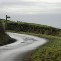
A single track road leads out of Staveley through Over Staveley towards Park House Farm, OL7 SD4700. The lane is a dead end and narrow but as it is February, we managed to tuck into the hedge sufficiently to allow tractors to pass – we hoped!
A clearly marked footpath directed us from the road up to Brunt Knot via Brunt Knott Farm. The clouds were distant, so we could see over the higher peaks with the Langdales, if not exactly clear, still impressive in their jagged outline.
The path doesn’t go quite to the top of Burnt Knott (427m) but skirts round the south side before dropping down into  Longsleddale. Without counting contours, I think we were around 300m and once there you will certainly feel remote. No signs of people and for once, there weren’t even any sheep. The snow must have been quite deep the previous week as there was still the odd pocket and where water had collected it was still frozen. Jumping down from a ladder stile, I expected a mushy landing not the hard, frozen peat.
The gap in the bracken, on the descending side, made it easy to see the way down to Longsleddale. Large boulders are scattered haphazardly along the glaciated valley of the river Sprint. The path hugs the valley side for the most part, but touches the almost spirit level floor for a short distance. We didn’t see any other walkers, but were greeted by couple of Landrover drivers having an extended chat on a farm drive.
Walking north we could see the eastern side of the Kentmere Horseshoe before the mist started to drop down very quickly and we were glad of the distinct bridle way to follow both along the valley and back up on to the fell. This side of Brunt Knott is marked as Sleddale Forest but is now just heather and moss. It is strikingly different in colour from the peat bog and cotton grass tufts which surround Skeggles Water. Keep to the track on the top as it is very wet around the tarn. Added to the wet from below cloud had now dropped upon us and we completed our walk through drizzly rain. The visibility was not good, but the path was easy to follow down and shortly became a well defined farm track leading to Park House Farm.
Although a damp end to the day, by choosing the lower, eastern fells we had missed ‘the buffeting winds, low cloud and temperatures feeling like 0°’ predicted by MWIS on the more central fells. Find details, though beginning from Longsleddale Church, walk 46
For a change, take a look at some of my other writing – a review of Berlin here, and a review of Martha, Marcy May, Marlene here
