Map, Book or Take a Friend?
Just a few questions. How do you decide on your route when planning a walk? Are you currently working through a list of Wainwrights, Burkett’s, Monros or Marilyn? OK, so these may give you an idea of where you want to go. After ridiculing ‘baggers’ for sometime I have to admit to jumping on that particular bandwagon and be counting my Wainwrights. But, Wainwright or not, because of our network of paths, bridle ways and open access there are so many ways to hit a hill in Cumbria.
Are you an expert navigator and do you just follow the map? When I first moved back north I ‘bought a book’, a sensible solution to many problems. The trouble with walking books is they all say you must have a ‘good map’. So, back to that gigantic paper chart more useful as a table cloth than something to follow on a walk. Well, that’s what I used to think when doing A level geography, which somehow lead to a short spell of orienteering. Before the days of photocopies and the digital world I even used to tear them up at the folds I found them so frustrating – oh the rashness of youth. Just think of all that money I could have made selling my old OS maps?

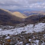
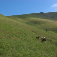
Up the shoulder of Seat Sandal
Back to the point. A good map. My problem now is I can’t see them. Or rather my arms are not long enough. How many of you have tried to put you eyes on in a gale where optical goggles would have been more appropriate than reading glasses. I did meet someone who wore one contact lens. This apparently gets around the problem I have of not being able to read the map without specs, but not being able to see where I am going with them.
So, maps. Green dots and dashes are wonderful. I like them. I can see them. But those little tracks on the ground, the small grey lines. Not quite so easy to read on a map, but when you get there, where ever there may be, you can see the track, which is not always the case for the more obvious green.

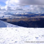
Dollywagon – I think
Why harp on about this now? Because of my recent mission to bag the W’s and having limited time on a couple of days I looked down the list on the past two Sundays and decided I could ‘quickly’ fit in a hill before the more mundane aspects of the day took over. First on the list was Stone Arthur, info here, which was fine. I checked my list, looked at the map and found some appropriate and convenient green lines to follow. Rare it must be, but the one down from Heron Pike had not been used very much and so, although a right of way there was no indication of where it was on the ground at all.

.. and I hope this is St Sunday
The following week selecting Seat Sandal, started in the same way. Though looking at the green lines I would have had to retrace my steps down to Grisedale Hause whichever line I followed up. Books. One came in again. Bill Birketts route up, which I followed here, uses the black dashes. Which I can only see when blown to immense scale on OSGetamap, and actually follows a line up the shoulder which has neither black or green and so I would never have thought of taking it. But it was perfect. I don’t like retracing my steps. I circular route is so much more satisfying. On the map the dots do come to an end at around the 450 contour, but in actuality there is a clear path all the way to the top. If I had looked at Birkett the week before it would have been better to go up one and down the other, but then the tongue is rather a pretty valley.

Down Tongue Gill
So where does a friend come in? Most of the time actually. It is so easy to be lazy, trust someone else and off load all responsibility. Just as I did on my pinnacle of achievement over Sharp Edge. Somewhere so well trod and polished ‘a friend’ with prior experience was as essential as my boots!
As a final question to all this blurb; sat navs? Who has one? Should I buy one? Should I just get the app for my new phone which my ‘service provider’ tells me I must upgrade to? Again, until a misty hike in the Langdales recently I was a bit of luddite but we were so glad to see one that day, and it would save me time on plotting my maps.

So questions, your recommended books? or maps? OS do not have a monopoly – or do you just take a friend?
Bill’s Book