
Escape the Crowds
A day out with out seeing any other walkers on the hills was quite remarkable and very surprising. Though when I listened to the traffic reports of the M6 car park on my return home, I guess that is where everyone was. I was walking with family due to return to Australia the next day, and not used to walking our hills. This coupled with the uncertain weather situation, made me plan a walk with a low and a high option. Route to be decided by the height of the clouds and the state of antipodean legs.
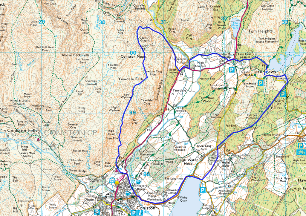
So, the walk. We set off from the National Trust Car Park at Tarn Hows, partially to take advantage of my NT free parking, but also convenient ‘conveniences’. Always a useful feature for the start of any walk. Go back up the road a short way, to the disabled car park, and opposite is a kissing gate. There is a straight line from here to Coniston Lake. Take it. Mainly through woodland, which still had a distinctly wintery feel.

The potting shed Monk Coniston
Emerging from the woodland, cross the road to Coniston and it is worth taking a detour into the old gardens of Monk Coniston. A walled garden undergoing loving restoration from the National Trust. No entry fee. After a meander through the veg beds and a peep in the potting sheds, continue down to Coniston Lake and, well, just enjoy.

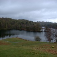
Looking south over Coniston
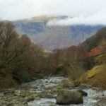
Tear yourself away from the lake shore and follow the road to Coniston. There is a footpath so no need to take your life in your hands. Just at the start of the village is a fork in the road with a handily placed bench for decision making. The shortest, quickest way back to Tarn Hows from here, is to follow the Cumbria way.

Alternative two is to follow the bridleway along the west side of the A593, but, at this stage, the antipodean legs were holding out quite well. They had only walked down hill and on the flat, so perhaps I wasn’t being quite fair, asking for a decision based on information so far. Anyway, I pointed out the Yewdale Fells on the map and was met with overwhelming enthusiasm for taking the ‘high road’.

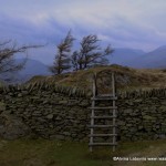
We followed signs to the Youth Hostel, the one pointing across the road, there are two. The start of the bridleway is well marked. The footpath not quite so, but you should spot the green track going straight up the hill side. There is some respite from the steepness at times. My visitors found the industrial heritage of copper and slate mines interesting. In places the ground has collapsed in to old mine workings and slate extraction still litters the landscape.

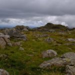
On top of the fell the path was not always easy to follow, especially as I decided a detour to Yewdale Crag would be a good idea. It was, as far as the vista over Coniston was concerned, but not as far as boggy terrain and dry feet went. But, as I explained, this was all part of the Cumbria experience. Once we had found the trail again on the Tilberthwaite end, there was an easy walk down to Shepherds Bridge and High Yewdale.

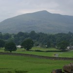
Windermere in the distance
Depending on your sense of adventure, avoid the main road with a short detour to Glen Mary Bridge, where you follow the road a short way to another National Trust car park. Again an option of a high road and water fall view, or a more easy stroll up the track back to Tarn Hows.

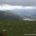
Coniston View from Yewdale Crag
I did throw in the suggestion that we might walk around the tarn, but was out voted by the antipodean tradition – beer O’clock!
Ideas for this walk came from Cicerone South Lakeland, walks 15 and 18 and you will need OL 7 map.