
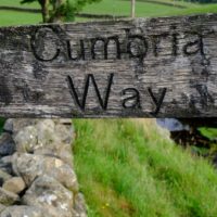
Walking the Cumbria Way In Five Days
Beginning in Ulverston,
the CW wanders as due north as possible.
Bar a brief hiccough on day two.
Through the Lake District National Park,
to its ultimate destination in Carlisle
a mere 70 miles later.
Day One Ulverston to Coniston 29.1 k 18.1 miles

The Start

Start in Ulverston
There is a plaque on the wall as the start of day 1. Clearly defined. Having been dropped off in the centre of the town, it took a little wandering before I found it. Then I headed out of town by Gill Banks Beck, meeting only early morning runners.
Soft hills and farmland commenced. The greatest challenge being a congestion of cows, reluctant to leave their farm for the parched pastures. Rising out of the valleys slightly, the best views were initially gained by glancing back towards Morecambe Bay and the now redundant light house.
Eventually signs of mountains hovered on the horizon and I could see soft mist spilling over the sides of Wetherlam. Blackberries made easy pickings along the hedgerows, growth encouraged by the heat of the past two months.

Wetherlam
Shortly after crossing into the Lake District National Park Tottlebank provides the entrance to the low fells and the first hint of wildness. Beacon Tarn shone brilliantly. Swimmers enjoying a place more usually shrouded in the drizzle which feeds it. Half way along Coniston, before Torver the track drops down to Coniston Water and strolls along the side through pine woods and campsites.

Coniston
Coniston is a natural stopping point. I’d left booking rather late and so had to hike up the hill to the Copper Mines YHA. The only place with a bed for one night. A steep final kilometre I could have done without.
Day Two Coniston to Langdale 20.5 k 12.8 miles

Deviating from north on a distinct dog leg, this was the easiest, shortest day of the five. There are shorter ways to cut over to Langdale from Coniston but for the sake of visual satisfaction and history, the route turns to Tarn Hows, taking in the falls at Colwith and Skelwith before entering the valley via Elterwater.

Tarn Hows
This day there were paths I’d never been on before. With the cris cross of trails in the Lakes, it’s impossible to set foot on each to every destination. My usual trails are to the to of a hill, so winding along the lower lanes and tracks I found vistas never before experienced and places for tea! Though this was more unusual. There is a cottage at High Park I’ve walked past many times before. This time it was open for lunch, tea and cakes. Their ‘hearty ploughman’s for hungry hikers’ was a well chosen option. Opening times are a little erratic, I was informed ‘oh, we only open when we feel like it’.

High Park
After a lazy lunch with views down the beautiful valley of little Langdale a meander down through woods, past waterfalls and into big brother , Great Langdale enjoying what was to be the last of summer, for a couple of days.
Day Three – Langdale to Keswick 28.3k

A hill of notable size to be conquered. One of only two on the route and typically, with grey cloud sat on the hills ahead. The day began with another trudge down Mickleden. This time though, taking a right turn at the head of the valley. Up the well stepped stair case to Stake Pass. Soft wet mist wrapping round to emphasise the splendid isolation. There was little to see on the top. Welcome to the Lake District. I wondered how some new friends I had met the previous day would fare with their navigation on the hills. From Belgium they were missing the way markers of the Alps. By standards the Cumbria Way route lacks clarity. Having to don my woolly hat and waterproofs confirmed the necessity of planning for all weathers despite the summer calendar.

Down the incongruously sculpted path by the side of Stake Beck into the picturesque Langstrath. The Cumbria Way route follows the east side of the valley but I’d be tempted to follow the west and see the lower falls. Joining the official route again in Stonethwaite. Which would, coincidentally, give another lunch opportunity at the pub in Stonethwaite. As it was I lunched at Yew Tree Farm, in Rosthwaite and enjoyed the best egg mayonnaise, door stop butty and mug of farmer’s tea.

Lowland wandering through the rest of the valley to the shores of Derwent followed. Taking a ferry into Keswick is an option and at the end of a long day. After all you’re still following the route. I didn’t, only because there was not a ferry when I needed one.
Day Four – Keswick to Caldbeck 24.8k

True to form the Way skirts round the big hills north of Keswick. Contouring round Latrigg, to the west and Lonscale Fell, to the east. Taking these lower routes was once again new to me. Even on a misty day the valleys had their own appeal. Skiddaw House hard to spot amongst its misty, protective ring of trees. Taking the shorter, apparently more difficult to navigate option from Skiddaw House, the Way heads north east along a stream, which eventually becomes the river Caldew. A uncanny feeling of remoteness, given its proximity to Keswick. Views muted by mist. The dome of Great Calva on one side, Blencathra and Mungrisdale on the other. Remoteness quickly dissipated when, at the junction with Grainsgill Beck, day trippers in flip-flops and sandals appeared along the track from Mosedale.

Grainsgill is perhaps the trickiest track on the Way. Indistinct and rough along the steeply rising gill. Mine workings and mineral deposits are scattered about the lower slopes. Along with warnings not to take anything away.
Visibility was not good and I imagine it is the top of the beck which the warnings of tricky navigation. As soon as a modicum of flat land is reached the route turns sharply right and heads off along an undefined track to the top of Hare Stones and ultimately High Pike. At 658m High Pike is the summit of the Cumbria Way and from there it is, almost, all down hill. By special order, a breeze came over and dragged the clouds away to reveal the Solway Firth and Scotland beyond. Necessary for the involvement of effort.

Then north and an easy track downhill to Caldbeck, ending in winding, country lanes feeling a million miles away from the remote source of the river Caldew.
Day Five – Calbeck to Carlisle 18.4k

Along the river Caldew from Caldbeck to Carlisle almost all the way. Calbeck Village sits astride Cald Beck and initially the Cumbria Way follows this east to where it re-joins the Caldew. Now wider and more languid than first meeting. Soon the all contours fall and away and the landscape becomes almost unrecognisable from that only a day away. Approaching Dalston off shoots of the river are artificially confined as they flow through winding lanes more akin to the Cotswolds than Cumbria. Then there is cake. Dalston has tea shops in abundance and if you haven’t had lunch, here would be the place to eat. Choices abound.

Dalston also has a train station. Not being a purist and not feeling the need to walk the last five miles along a river which I felt perfectly well acquainted I quit. 65 of the 70 miles complete with another two weeks of trekking in the Balkans scheduled to start within 3 days. I decided to let the train take the strain and view the remainder of the route from the comfort of a moving seat.
Hi Alvina,
A really good read of your Cumbria Way trip.
Re You finishing the walk at Dalston. A lot of people would say that the Cumbria Way is let down by the last few miles from Dalston into Carlisle. Given the countryside you have walked through in the previous days it is not exactly the culmination of 5 days fantastic walking you would expect especially with no official end point or marker to mark your finish in Carlisle.
Next time I walk the CW I will follow the advice of a growing number of people and start in Carlisle thereby getting the ‘grotty’ section out of the way first leaving only the good stuff ahead.
Thank you Dik, glad you enjoyed the read and good advice on the North to South route.