Walk for a Bad Weather Day
Broughton in Furness sits just within the park.
With the rugged hills of the central fells so close why bother with a small market town at the top end of the Duddon Estuary.
Try the weather forecast. With ‘considerable buffeting’, thunder storms and heavy rain high on the agenda a low level walk was quite attractive.
Staying indoors was not an option.
We even sat in the car to put our boots on, the rain was pretty torrential.
The brightly painted buildings in the square seemingly the only colour.

Broughton Square
But only 5 minutes walk and rich deep grass, all be it a little damp, lifted our spirits, if not the clouds.

Walking outside the ‘intake walk’ is far softer. Pasture and woodlands not found on the fells.

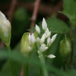
Spring means bluebells and here they were in abundance. Splashed across the hills in vast swathes and fighting for light under the trees. Trees growing thick and strong, sheltered from, not battered by upland gales.

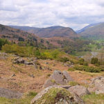
We made our way across through woods and marshes, skirting the edge of the Furness hills, to the first high point,

Latter Rigg
at Latter Rigg. Insignificant maybe at only 80m, but someone had thought fit to build a cairn, and it provided adequate shelter for a coffee stop.

Top of Latter Rigg
Before us someone had loved the valley as there are two strategically place seats.

We did get a little over 100m later on, but only because we missed our way and were, at one point, heading over the hills to Coniston.

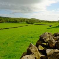
An abundance of paths cross the valley, winding down through picturesque farms and lanes.
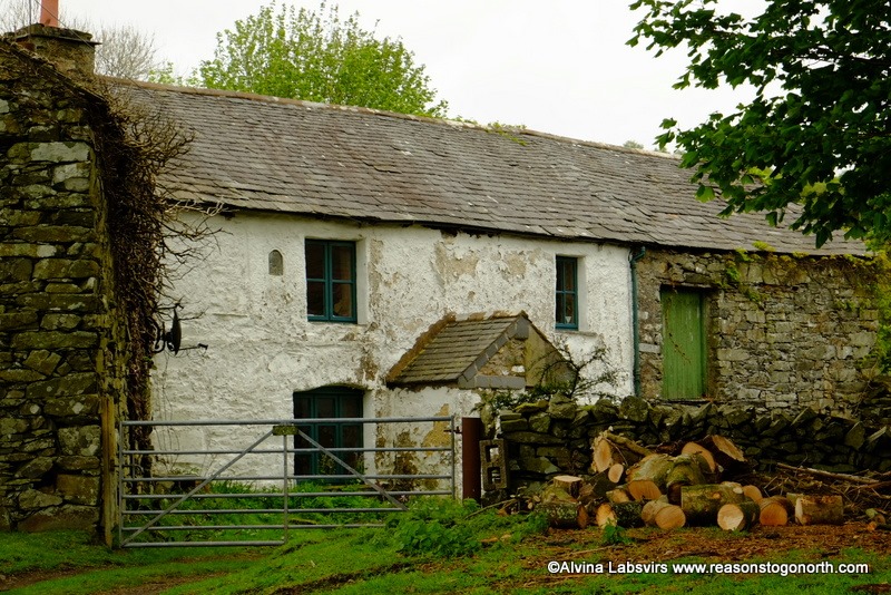
Green Moor Farm
Herdies may be hefted a few miles higher but this rather resplendently clad chap showed his displeasure at our presence by haughtily stamping his feet.

We skirted the valley for the next few miles. Hugging the lower western slopes of Blawith Fells. Although Fairley close to the A593, and criss crossed by footpaths and farm lanes, the only signs of life were farmers feeding stock.

Climb Stile (another odd place name)
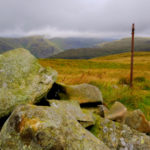
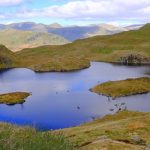
Our second and final climb over 100m was the edge of The Knott from where we began to drop down to the plain.

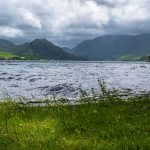
Tarn with no name on Great Intake
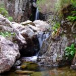
Water draining from the hills gathered into larger streams, tumbling over rocks, feeding lush undergrowth and tiny tarns. Waterways crossed by ancient bridges and rights of way.

Woodland Grove
Tracing the valley on the opposite side the crisp light left by grey storms painted the sky and hiked up the colour saturation.

There was a little shopping to be done

Shop at Mireside Farm
and then a short stroll in the park land of Broughton Tower bringing us full circle to the village square.

This was an unexpectedly wonderful walk. I had no idea of how pretty the area round Broughton is. The walk came from this Cicerone book and a really lovely alternative to battling the elements in inclement weather.
")
Bridge in Woodland Grove
Take a look at a few more pictures of the day here.
The route, a little over 11 miles (with mistake)